Graphing Thermal Expansion of Water & Greenhouse Gases
Teacher Background
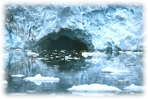 Humans are only able to live on Earth because of a "greenhouse effect." Without this our world would have been too cold for life to have colonized the surface of the planet. Life subsequently "terraformed" Earth: living organisms, cyanobacteria or blue-green algae, "made" the oxygen we humans need to survive. Life today is the product of changes in Earth's atmosphere caused by ancient life. Climate change is natural and real: without it we would not exist. But all this happened over millions and millions of years. Climate change today is also real, but it's happening during our lifetime and many experts consider our way of life – industrialization and the use of fossil fuels – to be the primary cause. In order to understand the present climate and what may be ahead, scientists are collecting information stored in rocks, ice, and sediment to understand Earth's climate history. They are taking the ocean's temperature and measuring the extent of sea-ice cover. They are probing beneath thick glaciers and drilling through multi-million year old ice sheets. They are recording carbon dioxide and methane levels. And most of this exploration and research is happening in the polar regions. In terms of global climate change, the Poles turn out to be more sensitive than anywhere else on Earth. Climate change, in a sense, begins at the ends our planet. Humans are only able to live on Earth because of a "greenhouse effect." Without this our world would have been too cold for life to have colonized the surface of the planet. Life subsequently "terraformed" Earth: living organisms, cyanobacteria or blue-green algae, "made" the oxygen we humans need to survive. Life today is the product of changes in Earth's atmosphere caused by ancient life. Climate change is natural and real: without it we would not exist. But all this happened over millions and millions of years. Climate change today is also real, but it's happening during our lifetime and many experts consider our way of life – industrialization and the use of fossil fuels – to be the primary cause. In order to understand the present climate and what may be ahead, scientists are collecting information stored in rocks, ice, and sediment to understand Earth's climate history. They are taking the ocean's temperature and measuring the extent of sea-ice cover. They are probing beneath thick glaciers and drilling through multi-million year old ice sheets. They are recording carbon dioxide and methane levels. And most of this exploration and research is happening in the polar regions. In terms of global climate change, the Poles turn out to be more sensitive than anywhere else on Earth. Climate change, in a sense, begins at the ends our planet.
Activity 1:
What Impact Might Sea Level Rise Have?
Objective
- To have students observe the effect of thermal expansion on water level
Engage
If global temperatures increase, many scientists have indicated that an increase in sea level is the most likely secondary effect. Two factors will contribute to this accelerated rise in sea level.
First, although the oceans have an enormous heat storage capacity, if global atmospheric temperatures rise, the oceans will absorb heat and expand ("thermal expansion") leading to a rise in sea level.
Second, warmer temperatures will cause ice currently locked up in glaciers and snowfields on land to melt, thereby increasing the amount of water in the oceans. An accelerated rise in sea level would inundate coastal wetlands and lowlands, increase the rate of shoreline erosion, exacerbate coastal flooding, raise water tables, threaten coastal structures, and increase the salinity of rivers, bays, and aquifers.
Explore/Explain
Materials: (for each team of 4 students)
- conical flask
- portable clamp-on reflector lamp
- two-hole cork for flask
- 150-watt floodlight
- thin glass tube
- dye
- long thermometer
Procedure:
- Completely fill the flask with very cold water (to improve visibility, dye can be added.)
- Place the cork in the stopper. Slide the thermometer and glass tube in the holes in the cork. The water should rise a short way into the tube. Have students record both the temperature of the water and the water level in the glass on their data sheets.
- Have students predict what will happen to the water level when the flask is exposed to heat and record this prediction on their data sheet. Place the flask under the lamp. Turn on the lamp and record measurements every 2 minutes.
Expand:
- Make a graph of the thermal expansion experiment.
- Summarize the results of the lab and relate to the problems of global warming and sea level rise.
- Challenge your students to design an experiment using ice cubes to test their hypothesis in the final discussion question. (See also Activity 3)
Discussion:
- Why did the level of water in the flask change?
- What does this experiment suggest might occur if the oceans warm? Challenge your students to consider the possible impacts of sea-level rise in areas such as Bangladesh or South Florida.
- If global warming is not sufficient to cause significant snow and ice melt, would you expect this thermal expansion to be enough to cause coastal flooding and erosion problems?
- Which would you expect to have a greater effect on sea level – the melting of Arctic sea-ice, the Greenland ice cap, or ice sheets in the Antarctic? (This is a big of a trick question: the melting of sea-ice has no effect on sea levels, except in "uncorking" glaciers and ice streams which then can flow more easily down into the ocean. It's dynamic ice sheets such as that in Greenland and in West Antarctica that could, potentially, have a major impact on sea level. East Antarctica, for now, seems relatively stable, and actually seems to be gaining ice. For more, see Activity 3.)
This activity was excerpted from P2K's LIVE FROM ANTARCTICA Teacher's Guide and originally adapted from "Global Change Education Resource Guide," published by UCAR/NOAA, p. III, 19-24, based on an EPA Report.
Activity 2:
Analyzing Greenhouse Gases Over Time
Objectives
- To have students organize raw data by using charts and graphs
- To have students analyze the charts and graphs to see trends in the data and extend the analysis into the future
- To have students draw valid conclusions based on authentic research data.
Engage
Inform students that they have been assigned a position in a research institution dealing with global issues. A research scientist has just given them "raw data." Within the week a major international conference on this material will be held and they need to analyze the data. The data need to be presented and organized in a meaningful and useful way.
Explore/Explain
Materials: (for each team of students)
- raw data
- pencil
- graph paper
- ruler
- Note: students can plot the data by hand or use appropriate computer software
Procedure:
- Discuss where data come from, types of graphs available, what a trend is, and how to project a trend.
- Divide class into small teams and have each team use different data sets.
- Have students simulate the role of a research scientist. (It might be interesting to have them write a description of the kind of person they expect such a researcher to be. Then have them compare their expectations with the scientists seen during the POLAR-PALOOZA video podcasts.)
- Using accompanying data, have students plot the values and make the curve for at least one graph. Make sure different graphs are assigned so they each can be discussed.
- Upon completion of the graph(s), have students continue the trend of the curve for another 50 years.
- Have each student or student group develop a conclusion for their particular graph. Have students with the same graph get together and compare graphs for accuracy and conclusions.
- Ask for a spokesperson for each type of graph to report a consensus view and a minority view for the interpretation of the graph.
- Discuss the role of data analysis in scientific research. How do choices in displaying data affect communication?
Expand:
- Make a display of the various graphs and conclusions.
- Explore the Internet for raw data currently being reported by scientists working in Antarctica or in Greenland. Follow the analytic procedures and report findings to the class.
- The graphs will indicate a rising trend in several greenhouse gases. The debate about the increase in greenhouse gases as a major factor in global warming continues. But it is important to note the reduction in CFC levels which was the result of an international agreement to decrease production. CFCs are not only a greenhouse gas, but also destroy the ozone layer which protects us from the sun's harmful ultraviolet radiation.
Raw Data
Atmospheric Greenhouse Gases Affected by Human Activities
ppmv = Parts per million by volume
Click Here to Download the Data in MS Excel Format
CO2 Concentration
| Year |
ppmv |
| 1958 |
314.8 |
| 1959 |
316.1 |
| 1960 |
317.0 |
| 1961 |
317.7 |
| 1962 |
318.6 |
| 1963 |
319.1 |
| 1964 |
319.4 |
| 1965 |
320.4 |
| 1966 |
321.1 |
| 1967 |
322.0 |
| 1968 |
322.8 |
| 1969 |
324.2 |
| 1970 |
325.5 |
| 1971 |
326.5 |
| 1972 |
327.6 |
| 1973 |
329.8 |
| 1974 |
330.4 |
| 1975 |
331.0 |
| 1976 |
332.1 |
| 1977 |
333.6 |
| 1978 |
335.2 |
| 1979 |
336.5 |
| 1980 |
338.4 |
| 1981 |
339.5 |
| 1982 |
340.8 |
| 1983 |
342.8 |
| 1984 |
344.3 |
| 1985 |
345.7 |
| 1986 |
346.9 |
| 1987 |
348.6 |
| 1988 |
351.2 |
| 1989 |
352.9 |
| 1990 |
354.2 |
| 1991 |
355.6 |
| 1992 |
356.4 |
| 1993 |
357.0 |
| 1994 |
358.9 |
| 1995 |
360.9 |
| 1996 |
362.6 |
| 1997 |
363.8 |
| 1998 |
366.6 |
| 1999 |
368.3 |
| 2000 |
369.5 |
| 2001 |
371.0 |
| 2002 |
373.1 |
| 2003 |
375.6 |
| 2004 |
377.4 |
|
Methane Concentration
| Year |
ppmv |
| 1850 |
0.90 |
| 1879 |
0.93 |
| 1880 |
0.90 |
| 1892 |
0.88 |
| 1908 |
1.00 |
| 1917 |
1.00 |
| 1918 |
1.02 |
| 1927 |
1.03 |
| 1929 |
1.13 |
| 1940 |
1.12 |
| 1949 |
1.18 |
| 1950 |
1.20 |
| 1955 |
1.26 |
| 1956 |
1.30 |
| 1957 |
1.34 |
| 1958 |
1.35 |
|
| Year |
ppmv |
| 1975 |
1.45 |
| 1976 |
1.47 |
| 1977 |
1.50 |
| 1978 |
1.52 |
| 1979 |
1.55 |
| 1980 |
1.56 |
| 1981 |
1.58 |
| 1982 |
1.60 |
| 1983 |
1.60 |
| 1984 |
1.61 |
| 1985 |
1.62 |
| 1986 |
1.63 |
| 1987 |
1.65 |
| 1988 |
1.67 |
| 1989 |
1.69 |
| 1990 |
1.72 |
|
CFC Production
| Year |
Amount |
| 1955 |
100 |
| 1957 |
120 |
| 1959 |
140 |
| 1961 |
150 |
| 1963 |
150 |
| 1965 |
200 |
| 1967 |
225 |
| 1969 |
290 |
| 1971 |
320 |
| 1973 |
375 |
| 1975 |
350 |
| 1977 |
360 |
| 1979 |
330 |
| 1981 |
325 |
| 1983 |
320 |
| 1985 |
340 |
| 1987 |
300 |
| 1989 |
305 |
| 1991 |
310 |
|
Nitrous Oxide
| Year |
ppmv |
| 1750 |
283.0 |
| 1760 |
283.5 |
| 1770 |
284.0 |
| 1780 |
284.0 |
| 1790 |
285.0 |
| 1800 |
285.5 |
| 1810 |
286.0 |
| 1820 |
286.5 |
| 1830 |
287.0 |
| 1840 |
287.5 |
| 1850 |
288.0 |
| 1860 |
288.5 |
| 1870 |
289.0 |
| 1880 |
289.5 |
| 1890 |
290.0 |
| 1900 |
291.0 |
| 1910 |
292.0 |
| 1920 |
292.5 |
| 1930 |
293.0 |
| 1940 |
294.0 |
| 1950 |
295.0 |
| 1960 |
297.0 |
| 1970 |
299.0 |
| 1980 |
305.0 |
| 1990 |
310.0 |
|
The above activities are excerpted from P2K's LIVE FROM ANTARCTICA 2 Teacher's Guide.
For more information go to passporttoknowledge.com/antarctica
|