
Jeff Trapp, Ph. D.- NOAA/NSSL 02/24/00
Research Meteorologist,
NOAA/National Severe Storms Laboratory and
Cooperative Institute for Mesoscale Meteorological Studies
Boulder, CO

|
|
IPEX field Log for the Final IOP, DOW 2 Jeff Trapp, Ph. D.- NOAA/NSSL 02/24/00 Research Meteorologist, NOAA/National Severe Storms Laboratory and Cooperative Institute for Mesoscale Meteorological Studies Boulder, CO |
|
|
3:45
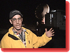
am The P3 is now in the air. We listen to the radio communication between the P3 scientists and the Ops Center, and adapt our radar scanning strategies according to the P3 mission at specific times.
I was joined a couple of hours ago by Jeb Stewart, a University of Utah meteorology student. It's helpful to have someone share the DOW duties, especially in the early-morning hours when my mind is not particularly clear (I slept a whopping three hours last night; the transition from daytime operations to nighttime operations has been brutal!) Jeb just finished answering some questions of a curious visitor on his way to one of the plants several kilometers down the road from us. The truck's flashing amber lights and the flood light that illuminates the radar dish attract a lot of attention. I've been having a few problems with DOW2's radar transmitter. Steve McDonald is in DOW3, helping me troubleshoot via cell phone. To make matters worse, Jeb has noticed that the antenna is spending only about one-half of its full rotation at a single elevation angle before jumping up to a higher elevation angle. I'm reminded now of a conversation held a few nights ago with my wife Sonia, who also has participated in meteorological field projects (as part of her doctoral dissertation research, she helped collect data on Florida cumulus clouds, in a project called the "Small Cumulus Microphysics Study," also affectionately known as "scum" by the scientists involved): one of the unfortunate inevitabilities of field research is that at least one observing instrument seems to experience a problem during a critical time!
Both radars now are being scanned over relatively small angular sectors, instead of over the full 360 degrees. This allows us to observe the 3D evolution of a small area of the snowfall every 90 seconds. Fortunately, these "sector scans" don't have the elevation-angle jumping problem that had been occurring earlier. With two radars, we're essentially observing the snowfall in stereo. What this means is that after applying some geometry to the Doppler velocity data, we'll be able to retrieve the full 3D airflow within the snowfall. And, this in turn means that we'll have unprecedented information on the complex air currents that result in the snowfall in the Wasatch Mountains, which ultimately will mean a better understanding of the snowfall and more accurate snow forecasts. |
| Non-Flash Journal Index | IPEX Log for DOW #2 1 2 |
![]()
 Today
is the first of two expected early-morning (yawn!) deployments. We will
focus our observing resources on the passage of a cold front: this weather
system is associated with much colder air than we've experienced thus
far in the project. Tomorrow, the "progs" (computer weather model prognoses)
are suggesting that the post-frontal cold air and northwesterly winds
will make for a orographic or terrain-enhanced snowfall event of the type
we've yet to observe (even though it is considered to be the more typical
type of event to occur in northern Utah in February. February 2000, however,
has not been typical!)
Today
is the first of two expected early-morning (yawn!) deployments. We will
focus our observing resources on the passage of a cold front: this weather
system is associated with much colder air than we've experienced thus
far in the project. Tomorrow, the "progs" (computer weather model prognoses)
are suggesting that the post-frontal cold air and northwesterly winds
will make for a orographic or terrain-enhanced snowfall event of the type
we've yet to observe (even though it is considered to be the more typical
type of event to occur in northern Utah in February. February 2000, however,
has not been typical!)
 6:55
am
6:55
am  9:00
am
9:00
am