|
This
is pretty top of the line as far as busy-ness and severe weather, by December
standards. In May we are used to days like this, where there is fairly
widespread severe weather and tornadoes-April, May, and even June, this
is pretty par for the course, but we haven't had any event like this since
probably early June here. So it is pretty active, a little more than we
were expecting today!
 It's
very much a team effort. I sort of became designated as one of the initial
warning forecasters... (the microwave beeps!) I did not get to eat before
now, so I'm just fixing my late snack! I got designated as one of the
primary warning forecasters... (Dave Floyd and I were both acting as warning
forecasters), and then I ended up adopting the storms which developed
tornadic circulation, so I was sort of captain of that ball game for a
while. But it really is a team effort, because I was using one of the
other forecasters who was looking at the radar on a different piece of
equipment It's
very much a team effort. I sort of became designated as one of the initial
warning forecasters... (the microwave beeps!) I did not get to eat before
now, so I'm just fixing my late snack! I got designated as one of the
primary warning forecasters... (Dave Floyd and I were both acting as warning
forecasters), and then I ended up adopting the storms which developed
tornadic circulation, so I was sort of captain of that ball game for a
while. But it really is a team effort, because I was using one of the
other forecasters who was looking at the radar on a different piece of
equipment 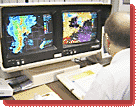 and
getting a different view of it, and getting reports from the amateur radio
operators and television and everything. And there is a lot of data to
put together, to assimilate when making decisions, if this storm is worth
a tornado warning and so forth. So things really worked together well
tonight and I think we were able to give good warnings ahead of the tornadoes
that they had there in Logan and Noble counties. and
getting a different view of it, and getting reports from the amateur radio
operators and television and everything. And there is a lot of data to
put together, to assimilate when making decisions, if this storm is worth
a tornado warning and so forth. So things really worked together well
tonight and I think we were able to give good warnings ahead of the tornadoes
that they had there in Logan and Noble counties.
We're
pretty proactive here at our office to try to determine what storms are
doing, what kinds of weather they are producing at the ground, because
radar only gives part of the equation. You can see a lot of things with
the radar but it won't actually tell you what is actually happening at
the ground, so we have a good network of spotters... But lots of times
storms fall in places where spotters are not deployed or where people
are not looking at it.
 Joey
works the phones, interacting with the public. So we have a few names
of just public folks in a few books out there so that if the storm is
in the vicinity and we don't have any organized spotter effort there we
will call the public and find out what size hail they have been getting,
if they have been getting strong winds associated with it. That really
helps us in the operations to get a feel Joey
works the phones, interacting with the public. So we have a few names
of just public folks in a few books out there so that if the storm is
in the vicinity and we don't have any organized spotter effort there we
will call the public and find out what size hail they have been getting,
if they have been getting strong winds associated with it. That really
helps us in the operations to get a feel  for
what the storm is producing and then we use that down the line to say,
"we see this on the radar and that produced nickel sized hail so this
one is probably producing nickel sized hail as well. So it gives us good
verification of what the radar is seeing. for
what the storm is producing and then we use that down the line to say,
"we see this on the radar and that produced nickel sized hail so this
one is probably producing nickel sized hail as well. So it gives us good
verification of what the radar is seeing.
 It's
a pretty good feeling. There is a lot of busy-ness to it, as you could
see. And sometimes just trying to gather and put together all the data
you are getting in both from radar and from spotters and the highway patrol
and people in the field.... Sometimes you don't have the initial impact
that these are affecting people... but in the back of your mind that is
part of the game too. It's
a pretty good feeling. There is a lot of busy-ness to it, as you could
see. And sometimes just trying to gather and put together all the data
you are getting in both from radar and from spotters and the highway patrol
and people in the field.... Sometimes you don't have the initial impact
that these are affecting people... but in the back of your mind that is
part of the game too.
And
when things calm down a little bit and you see that you got warnings out
and were able to give some advance warning of a tornado that developed
like today then that gives you a good sense of satisfaction. That you
played a key  role
in the process and were hopefully able to help someone. Hopefully someone
was able to heed the warnings and were able to take shelter from what
developed. That was especially pronounced back in May 3rd, when we had
the very large and violent tornadoes that moved across the state, it was
very busy and very active here. But it is great to know that, you know,
the process works. That was an incredibly destructive tornado and it is
still miraculous that only 20 or so people were killed--which is still
unfortunate, but having been up into the damage area up in Oklahoma City
after that, it's just beyond belief to me that there were not hundreds
of people killed. So at some point it's good to be part of the process,
especially when it works as well as it did tonight or on May 3rd. role
in the process and were hopefully able to help someone. Hopefully someone
was able to heed the warnings and were able to take shelter from what
developed. That was especially pronounced back in May 3rd, when we had
the very large and violent tornadoes that moved across the state, it was
very busy and very active here. But it is great to know that, you know,
the process works. That was an incredibly destructive tornado and it is
still miraculous that only 20 or so people were killed--which is still
unfortunate, but having been up into the damage area up in Oklahoma City
after that, it's just beyond belief to me that there were not hundreds
of people killed. So at some point it's good to be part of the process,
especially when it works as well as it did tonight or on May 3rd.
|